Geospatial Software
Public repositoryUrban Mobility Intelligence Platform
Full-stack geospatial software for mobility analysis, transit accessibility, spatial data, APIs, and interactive maps using Python, GeoPandas, PostGIS, FastAPI, Next.js, TypeScript, and MapLibre.
In numbers
In numbers
- micromobility trip records
- 807,988
- transit stops
- 25,106
- cities
- 4
- accessibility grid cells
- 8,032
Context
A full-stack geospatial mobility platform for trip analysis, transit accessibility, spatial data, and interactive maps.
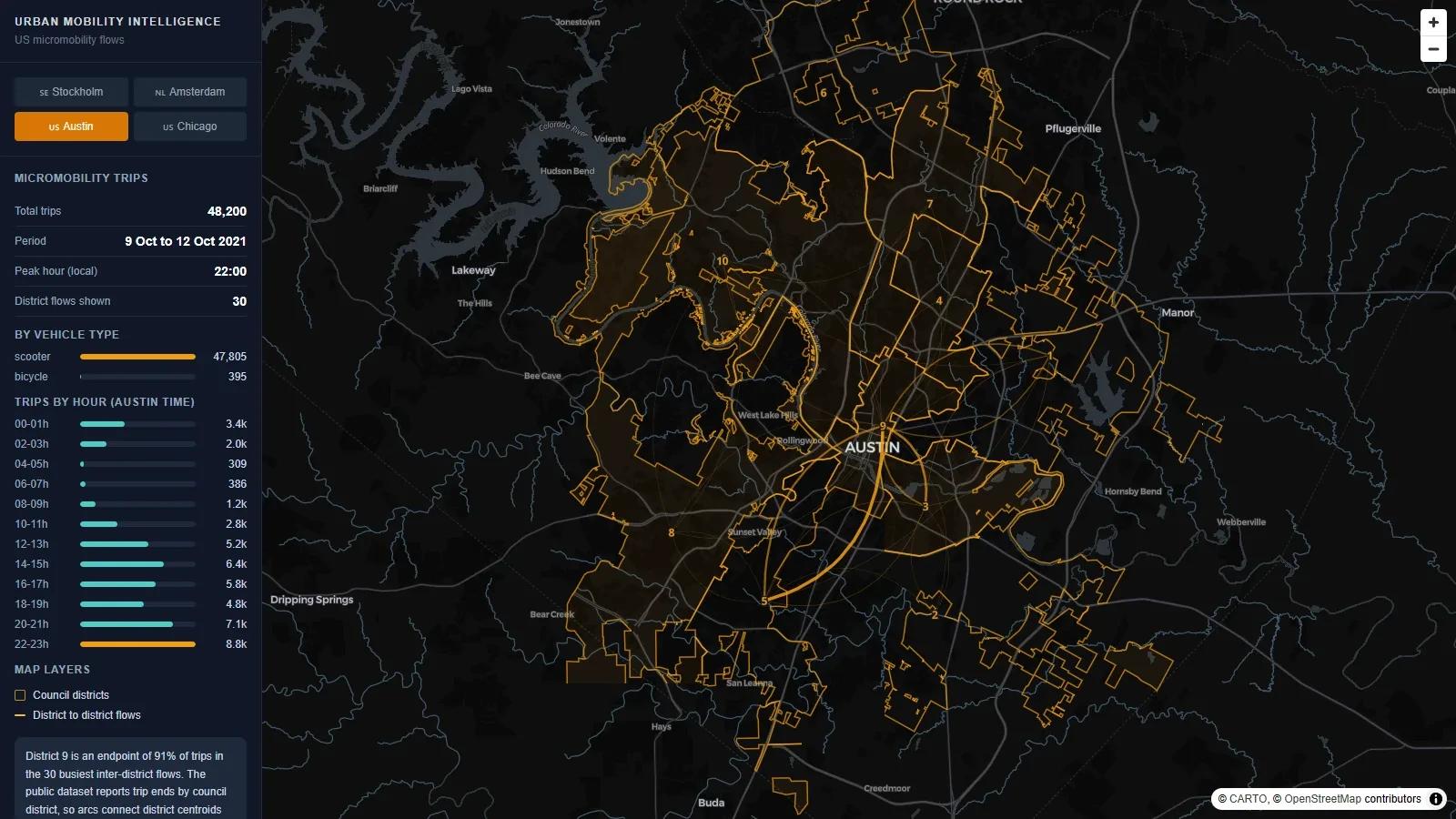
It combines micromobility datasets from Austin and Chicago with public transit datasets from Stockholm and Amsterdam: 807,988 trip records and 25,106 transit stops.
Approach
A Python, GeoPandas, and PostGIS data layer feeds a FastAPI backend. The Next.js, React, and TypeScript frontend renders the results on MapLibre maps, with vector tiles served from PostGIS via ST_AsMVT.
- Accessibility analysis across 8,032 grid cells and Weighted Linear Combination (WLC) analysis.
- Walking-network catchments with OSMnx.
- 14 REST endpoints and 21 automated test functions, with CI.
Features
Interactive maps
MapLibre maps with vector-tile delivery.
Transit accessibility
Accessibility analysis for Stockholm and Amsterdam transit networks.
Mobility flows
Trip analysis and mobility flows for Austin and Chicago.
Spatial filtering
Spatial filtering and transit views across the datasets.
Walking networks
Walking-network analysis with OSMnx catchments.
Spatial data layer
PostGIS with spatial SQL and vector tiles via ST_AsMVT.
Architecture
- Data
- GTFS, OpenStreetMap, WorldPop
- pandas, GeoPandas, Shapely
- OSMnx
- Storage
- PostGIS
- Vector tiles via ST_AsMVT
- API
- FastAPI
- 14 REST endpoints
- Interface
- Next.js, React, TypeScript
- MapLibre
Gallery
1 of 3Stockholm: transit accessibility score on a 500 m grid
Tech stack
- Python
- pandas
- GeoPandas
- Shapely
- PostGIS
- FastAPI
- Next.js
- React
- TypeScript
- MapLibre
- OSMnx
- GTFS
- OpenStreetMap